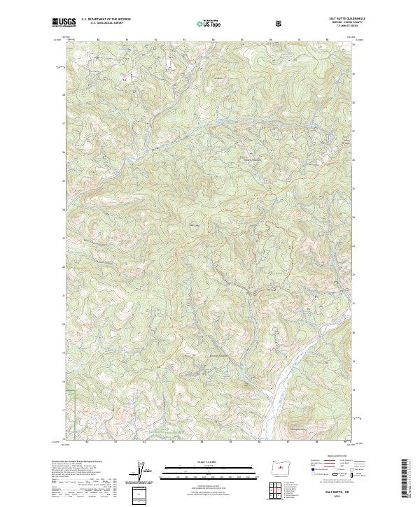
2023 Map of Salt Butte
USGS Topo · Published 2023About this map
Ochoco National Forest defines the character of this high-desert landscape in central Oregon, where the Ochoco Mountains transition into a complex network of drainages and volcanic features. This modern topographical study reveals a terrain shaped by water and time, from the prominent Salt Butte in the north to the striking rock formations of the Brennan Palisades further south. The drainage patterns are clearly delineated, with McKay Creek and its tributary Little McKay Creek carving through the northern sections while Mill Creek and Evans Creek gather flow from the southern slopes. Local history and recreation are reflected in modern trail names such as the Giddy-Up Go Trl and the Green Mountain Ohv Trl, which navigate the elevation gains near Green Mtn. This data provides a clear view of how natural water sources like Whitetail Spring and Kidnap Spring remain vital reference points in this arid environment.
Find a feature on this map
35 named features on this map. Tap any name to fly to it.
Don’t see what you’re looking for? This feature index may not catch every label — zoom into the map to look around manually.
Map Details
Editions of this 2023 Salt Butte Map
This is the sole edition of this map. No revisions or reprints were ever made.
Other maps of this area

1948 · Ochoco Reservoir
USGS Topo · 1:62,500

1950 · Ochoco Reservoir
USGS Topo · 1:62,500

1955 · Bend
USGS Topo · 1:250,000

1957 · Bend
USGS Topo · 1:250,000

1958 · Bend
USGS Topo · 1:250,000

1962 · Prineville
USGS Topo · 1:24,000

1962 · Prineville
USGS Topo · 1:62,500

1968 · Dutchman Creek
USGS Topo · 1:24,000

1968 · Opal Mountain
USGS Topo · 1:24,000
1969 · Foley Butte
USGS Topo · 1:24,000