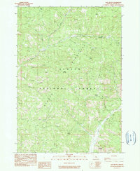
1990 Map of Salt Butte
USGS Topo · Published 1990About this map
The Ochocco Mountains dominate this 1990 topographical survey, showcasing a landscape defined by deep drainages and volcanic remnants within the Ochocco National Forest. The map documents a quiet industrial presence in the high country, with several labeled Quarry sites and evidence of earlier extraction efforts, such as a Mine Tunnel and a Mine Shaft located near the headwaters of McKay Creek.
Find a feature on this map
30 named features on this map. Tap any name to fly to it.
Don’t see what you’re looking for? This feature index may not catch every label — zoom into the map to look around manually.
Map Details
Editions of this 1990 Salt Butte Map
This is the sole edition of this map. No revisions or reprints were ever made.
Other maps of this area

1948 · Ochoco Reservoir
USGS Topo · 1:62,500

1950 · Ochoco Reservoir
USGS Topo · 1:62,500

1955 · Bend
USGS Topo · 1:250,000

1957 · Bend
USGS Topo · 1:250,000

1958 · Bend
USGS Topo · 1:250,000

1962 · Prineville
USGS Topo · 1:24,000

1962 · Prineville
USGS Topo · 1:62,500

1968 · Dutchman Creek
USGS Topo · 1:24,000

1968 · Opal Mountain
USGS Topo · 1:24,000
1969 · Foley Butte
USGS Topo · 1:24,000