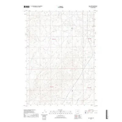
2017 Map of Salt Creek
USGS Topo · Published 2017About this map
The Salt Creek settlement and its surrounding high-plains terrain define this 2017 survey of Natrona County. This arid landscape is deeply etched by seasonal drainage systems, including the complex headwaters of Teapot Cr and the extensive winding path of Castle Cr with its S Fork Castle Cr. Prominent geological landmarks like the isolated Castle Rock rise above the network of draws and gulches, while the presence of Fensland Number 2 Reservoir highlights the necessity of water management in this dry region of Wyoming.
Find a feature on this map
15 named features on this map. Tap any name to fly to it.
Don’t see what you’re looking for? This feature index may not catch every label — zoom into the map to look around manually.
Map Details
Editions of this 2017 Salt Creek Map
This is the sole edition of this map. No revisions or reprints were ever made.
Other maps of this area

1955 · Arminto
USGS Topo · 1:250,000

1958 · Arminto
USGS Topo · 1:250,000

1959 · Edgerton
USGS Topo · 1:62,500

1959 · Ormsby Draw
USGS Topo · 1:62,500

1962 · Arminto
USGS Topo · 1:250,000

1968 · Big Gulch
USGS Topo · 1:24,000

1968 · Midwest
USGS Topo · 1:24,000

1968 · Salt Creek
USGS Topo · 1:24,000
1968 · Statzer Point
USGS Topo · 1:24,000
1968 · Teapot Rock
USGS Topo · 1:24,000