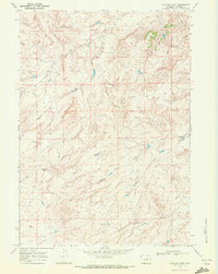
1968 Map of Statzer Point
USGS Topo · Published 1972About this map
Statzer Point serves as the topographic anchor for this section of the Wyoming high plains, a landscape defined by an intricate network of seasonal drainage and early industrial activity. The map reveals the hydrology of the eastern Wyoming basin, tracing the headwaters of South Fork Castle Creek and the meandering paths of Teapot Creek and Horse Ranch Creek. These watercourses carve through the undulating terrain, punctuated by significant landmarks like Henderson Draw.
Find a feature on this map
8 named features on this map. Tap any name to fly to it.
Don’t see what you’re looking for? This feature index may not catch every label — zoom into the map to look around manually.
Map Details
Editions of this 1968 Statzer Point Map
2 editions found
Other maps of this area

1955 · Arminto
USGS Topo · 1:250,000

1958 · Arminto
USGS Topo · 1:250,000

1962 · Arminto
USGS Topo · 1:250,000

1968 · Big Gulch
USGS Topo · 1:24,000

1968 · Merino
USGS Topo · 1:24,000

1968 · Illco
USGS Topo · 1:24,000

1968 · Salt Creek
USGS Topo · 1:24,000
1968 · Teapot Rock
USGS Topo · 1:24,000

1968 · Camel Hump Reservoir
USGS Topo · 1:24,000
1968 · Mc Pherson Draw
USGS Topo · 1:24,000