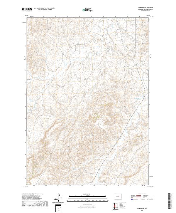
2021 Map of Salt Creek
USGS Topo · Published 2021About this map
Castle Rock stands as a prominent landmark in this corner of Natrona County, where the high plains terrain is defined by a complex network of draws and intermittent drainages. The landscape is characterized by the branching waters of Castle Cr and its S Fork Castle Cr, which carve through the varied topography alongside Stove Gulch and Big Gulch. This 2021 survey illustrates a region shaped by resource management and transportation, featuring the Fensland-Number 2 Reservoir and the winding path of Teapot Cr. The road network reveals the area's specific uses, with the Old Salt Creek Hwy and the notably named Naval Rd cutting across the township lines of T39N and T38N. These labels reflect the intersection of public land systems and historical infrastructure in the Wyoming interior.
Find a feature on this map
14 named features on this map. Tap any name to fly to it.
Don’t see what you’re looking for? This feature index may not catch every label — zoom into the map to look around manually.
Map Details
Editions of this 2021 Salt Creek Map
This is the sole edition of this map. No revisions or reprints were ever made.
Other maps of this area

1955 · Arminto
USGS Topo · 1:250,000

1958 · Arminto
USGS Topo · 1:250,000

1959 · Edgerton
USGS Topo · 1:62,500

1959 · Ormsby Draw
USGS Topo · 1:62,500

1962 · Arminto
USGS Topo · 1:250,000

1968 · Big Gulch
USGS Topo · 1:24,000

1968 · Midwest
USGS Topo · 1:24,000

1968 · Salt Creek
USGS Topo · 1:24,000
1968 · Statzer Point
USGS Topo · 1:24,000
1968 · Teapot Rock
USGS Topo · 1:24,000