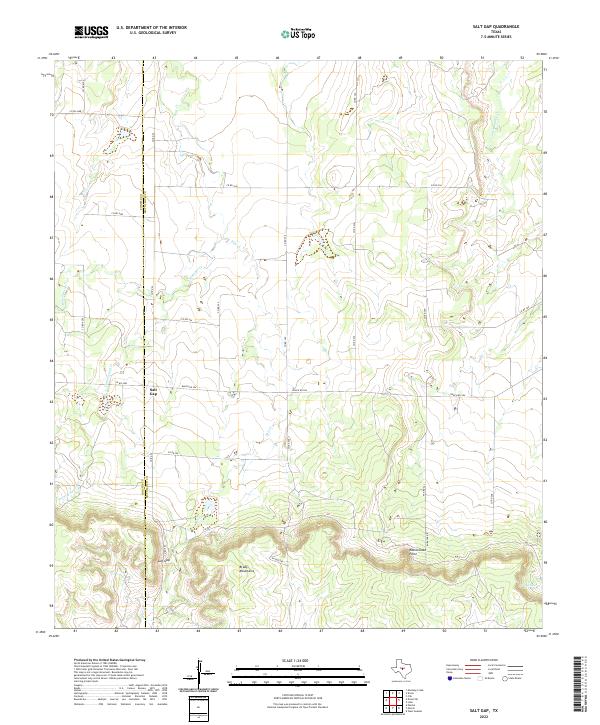
2022 Map of Salt Gap
USGS Topo · Published 2022About this map
The settlement of Salt Gap sits at the base of the Brady Mountains in this central Texas landscape. Located along the border of Concho Co and McCulloch Co, the area is defined by its drainage systems and significant topographic rises. Several seasonal waterways, including Salt Cr, Waloope Cr, and Cottonwood Cr, carve through the terrain. The southern portion of the map is dominated by the steep escarpment of the mountains, featuring distinct landmarks such as Rattlesnake Point. This map illustrates the rural infrastructure of the region, where a network of county roads like Co Rd 22 and Ranch Rd 504 connects remote ranching lands to the small community at the gap. To the east, the landscape transitions toward the drainage of Little Saddle Cr and Saddle Cr, reflecting the typical intermittent stream patterns of the Edwards Plateau's northern fringe.
Find a feature on this map
27 named features on this map. Tap any name to fly to it.
Don’t see what you’re looking for? This feature index may not catch every label — zoom into the map to look around manually.
Map Details
Editions of this 2022 Salt Gap Map
This is the sole edition of this map. No revisions or reprints were ever made.
Other maps of this area

1892 · Eden
USGS Topo · 1:125,000

1894 · Brady
USGS Topo · 1:125,000

1896 · Eden
USGS Topo · 1:125,000

1924 · Eden 1-a
USGS Topo · 1:48,000

1925 · Brady 2-b
USGS Topo · 1:48,000

1928 · Waldrip
USGS Topo · 1:62,500

1931 · Stacy
USGS Topo · 1:62,500

1954 · Brownwood
USGS Topo · 1:250,000

1960 · West Sweden
USGS Topo · 1:24,000

1960 · Melvin
USGS Topo · 1:24,000