
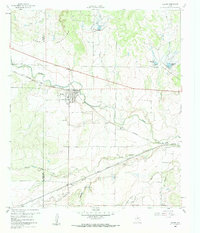
1960 Map of Melvin
USGS Topo · Published 1961About this map
Melvin sits at a critical junction of central Texas rail and water, where the Gulf Colorado and Santa Fe railway parallels the winding course of Brady Creek. This 1960 era survey reveals a landscape shaped by water management and transit, featuring a series of reservoirs including Reservoir No 39, Reservoir No 40, and Reservoir No 41 tucked into the northern elevations near the Brady Mountains. The town site itself is meticulously detailed, showing the residential grid, the nearby Melvin Cem, and several gravel pits that hint at local industrial activity. Further east, the small settlement of Whiteland and the rail split at Homer Junction highlight the importance of the railroad in connecting these rural McCulloch County communities. To the south, the terrain is defined by numerous seasonal drainages such as Clements Draw and Reubes Creek, which feed into the larger creek system.
Find a feature on this map
25 named features on this map. Tap any name to fly to it.
Don’t see what you’re looking for? This feature index may not catch every label — zoom into the map to look around manually.
Map Details
Editions of this 1960 Melvin Map
2 editions found
Other maps of this area

1892 · Eden
USGS Topo · 1:125,000

1894 · Brady
USGS Topo · 1:125,000

1896 · Eden
USGS Topo · 1:125,000

1928 · Waldrip
USGS Topo · 1:62,500

1931 · Stacy
USGS Topo · 1:62,500

1954 · Brownwood
USGS Topo · 1:250,000

1960 · West Sweden
USGS Topo · 1:24,000

1963 · Brady SW
USGS Topo · 1:24,000
1967 · Salt Gap
USGS Topo · 1:24,000
1967 · Doole SW
USGS Topo · 1:24,000