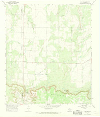
1967 Map of Salt Gap
USGS Topo · Published 1969About this map
The Salt Gap community sits at a crossroads in the late 1960s, marking the boundary between the Concho Co and McCulloch Co lines. The landscape here is defined by the northern escarpment of the Brady Mountains, where the elevation rises sharply from the drainage basins of Salt Creek and Waloope Creek. These intermittent streams carve through the limestone terrain, creating distinct landforms such as Rattlesnake Point and the high point known as Pear. The map reveals a ranching landscape dotted with various Gravel Pits and isolated water sources like Well locations, essential for livestock in this semi-arid region. To the northeast, the terrain softens around Little Saddle Creek and the landform labeled Saddle, illustrating the transition from the rugged mountain face to the rolling plains that characterize this portion of Central Texas.
Find a feature on this map
13 named features on this map. Tap any name to fly to it.
Don’t see what you’re looking for? This feature index may not catch every label — zoom into the map to look around manually.
Map Details
Editions of this 1967 Salt Gap Map
2 editions found
Other maps of this area

1892 · Eden
USGS Topo · 1:125,000

1894 · Brady
USGS Topo · 1:125,000

1896 · Eden
USGS Topo · 1:125,000

1924 · Eden 1-a
USGS Topo · 1:48,000

1925 · Brady 2-b
USGS Topo · 1:48,000

1928 · Waldrip
USGS Topo · 1:62,500

1931 · Stacy
USGS Topo · 1:62,500

1954 · Brownwood
USGS Topo · 1:250,000

1960 · West Sweden
USGS Topo · 1:24,000

1960 · Melvin
USGS Topo · 1:24,000