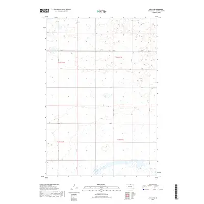
2017 Map of Salt Lake
USGS Topo · Published 2017About this map
Salt Lake and the surrounding prairie of Campbell County characterize this landscape in the northern plains. The terrain is marked by numerous seasonal wetlands and small basins, with prominent water bodies including Big Lake in the northwest and Goehring Lake situated between 115th St and 116th St. Small family and community cemeteries such as Sutley Cem, Brockels Cem, and Knodenfeldt Cem are scattered throughout the sections, providing essential landmarks for genealogical research in this rural township. The area is defined by a strict grid of section roads like 312th Ave and 119th St, reflecting the persistent agricultural organization of the Great Plains into the twenty-first century.
Find a feature on this map
23 named features on this map. Tap any name to fly to it.
Don’t see what you’re looking for? This feature index may not catch every label — zoom into the map to look around manually.
Map Details
Editions of this 2017 Salt Lake Map
This is the sole edition of this map. No revisions or reprints were ever made.
Other maps of this area

1953 · McIntosh
USGS Topo · 1:250,000

1954 · Aberdeen
USGS Topo · 1:250,000

1956 · Aberdeen
USGS Topo · 1:250,000

1958 · McIntosh
USGS Topo · 1:250,000

1965 · Herreid
USGS Topo · 1:24,000

1967 · Mound City
USGS Topo · 1:24,000

1967 · Selby
USGS Topo · 1:24,000

1978 · Salt Lake
USGS Topo · 1:24,000

1978 · Java SE
USGS Topo · 1:24,000
1978 · Java
USGS Topo · 1:24,000