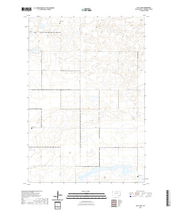
2021 Map of Salt Lake
USGS Topo · Published 2021About this map
Salt Lake and Goehring Lake anchor this rural landscape in Campbell County, which is defined by a grid of agricultural section lines and township boundaries. The area is characterized by low-lying wetlands and scattered depressions, typical of the glacial prairie pothole region. Small family burial grounds, including Knodenfeldt Cem, Brockels Cem, and Sutley Cem, are dispersed across the townships of t126n r76w and t125n r75w, providing vital clues for genealogists and local historians tracing early 20th-century settlement patterns. The map detail reflects a purely agrarian infrastructure, dominated by gravel roads and section markers such as 310th Ave and 114th St.
Find a feature on this map
23 named features on this map. Tap any name to fly to it.
Don’t see what you’re looking for? This feature index may not catch every label — zoom into the map to look around manually.
Map Details
Editions of this 2021 Salt Lake Map
This is the sole edition of this map. No revisions or reprints were ever made.
Other maps of this area

1953 · McIntosh
USGS Topo · 1:250,000

1954 · Aberdeen
USGS Topo · 1:250,000

1956 · Aberdeen
USGS Topo · 1:250,000

1958 · McIntosh
USGS Topo · 1:250,000

1965 · Herreid
USGS Topo · 1:24,000

1967 · Mound City
USGS Topo · 1:24,000

1967 · Selby
USGS Topo · 1:24,000

1978 · Salt Lake
USGS Topo · 1:24,000

1978 · Java SE
USGS Topo · 1:24,000
1978 · Java
USGS Topo · 1:24,000