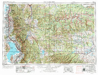
1954 Map of Salt Lake City
USGS Topo · Published 1973About this map
The Wasatch Range forms the towering eastern wall of the Salt Lake and Utah Valleys, creating a dramatic divide between the urban centers and the high wilderness of the Wasatch National Forest. This 1970 revision shows the rapid post-war growth of Salt Lake City and its surrounding communities, such as Murray and Midvale, clustered along the Jordan River and the Union Pacific RR corridor. To the south, the agricultural and industrial character of the Provo Bench is evident, leading toward the steel and resource infrastructure near Provo and the Keigley Quarry.
Find a feature on this map
236 named features on this map. Tap any name to fly to it.
Don’t see what you’re looking for? This feature index may not catch every label — zoom into the map to look around manually.
Map Details
Editions of this 1954 Salt Lake City Map
4 editions found

Other maps of this area

1885 · Salt Lake
USGS Topo · 1:250,000

1885 · Manti
USGS Topo · 1:250,000

1885 · East Tavaputs
USGS Topo · 1:250,000

1885 · Ashley
USGS Topo · 1:250,000

1885 · Sevier Desert
USGS Topo · 1:250,000

1885 · Uinta
USGS Topo · 1:250,000

1885 · Tooele Valley
USGS Topo · 1:250,000

1886 · Price River
USGS Topo · 1:250,000

1895 · Manti
USGS Topo · 1:250,000

1896 · Price River
USGS Topo · 1:250,000