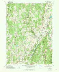
1963 Map of Salt Point
USGS Topo · Published 1970About this map
Wappinger Creek and its tributary, Little Wappinger Creek, anchor this mid-century portrait of Dutchess County. The landscape is defined by its small, scattered hamlets and an extensive network of specialized camps, such as Camp Nooteeming and Camp Victory, suggesting the area's role as a seasonal retreat. Local education and faith centers are prominently marked, including the Netherwood Sch and Westminster Ch near Salt Point. The map also captures the early industrial traces of the region, noting numerous Gravel Pits alongside more established settlements like Clinton Corners and Washington Hollow. Family history is reflected in several named landforms, including Cookingham Hill and Dennis Hill, which overlook the winding roads and small lakes that dot the interior hills east of the Hudson River.
Find a feature on this map
48 named features on this map. Tap any name to fly to it.
Don’t see what you’re looking for? This feature index may not catch every label — zoom into the map to look around manually.
Map Details
Editions of this 1963 Salt Point Map
Other maps of this area

1893 · Clove
USGS Topo · 1:62,500

1893 · Poughkeepsie
USGS Topo · 1:62,500

1894 · Clove
USGS Topo · 1:62,500

1894 · Poughkeepsie
USGS Topo · 1:62,500

1898 · Clove
USGS Topo · 1:62,500

1898 · Rhinebeck
USGS Topo · 1:62,500

1899 · Millbrook
USGS Topo · 1:62,500

1901 · Clove
USGS Topo · 1:62,500

1902 · Millbrook
USGS Topo · 1:62,500

1903 · Poughkeepsie
USGS Topo · 1:62,500