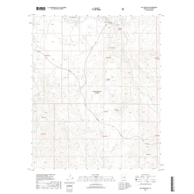
2018 Map of Salt River Peak
USGS Topo · Published 2018About this map
The Salt River carves a dramatic path through the northern reaches of this territory, passing beneath Meddler Point and into the steep descent of the Salt River Canyon. This 2018 survey reveals a landscape of intense relief within the Tonto National Forest, dominated by the rugged mass of the Salt River Mountains and the prominent Salt River Peak. The legendary Apache Trl winds its way through the center of the quadrangle, serving as the primary corridor through these high-elevation terrains. A network of vital water sources is scattered across the dry slopes, including Poison Spring, High Blevens Spring, and Thirtynine Spring. These springs and seasonal tanks like Barley Patch Tank supported cattle and travelers alike in an area defined by isolated peaks such as Klondike Mtn and the Gerald Hills.
Find a feature on this map
55 named features on this map. Tap any name to fly to it.
Don’t see what you’re looking for? This feature index may not catch every label — zoom into the map to look around manually.
Map Details
Editions of this 2018 Salt River Peak Map
This is the sole edition of this map. No revisions or reprints were ever made.
Other maps of this area

1900 · Florence
USGS Topo · 1:125,000

1901 · Globe
USGS Topo · 1:62,500

1902 · Globe
USGS Topo · 1:62,500

1902 · Florence
USGS Topo · 1:125,000

1907 · Roosevelt
USGS Topo · 1:125,000

1909 · Four Peaks
USGS Topo · 1:125,000

1912 · Roosevelt
USGS Topo · 1:125,000

1922 · Chrysotile
USGS Topo · 1:125,000

1945 · Globe
USGS Topo · 1:24,000

1945 · Inspiration
USGS Topo · 1:24,000