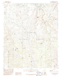
1986 Map of Salt River Peak
USGS Topo · Published 1986About this map
Salt River defines the northern boundary of this mid-1980s landscape, winding past Meddler Point and the prominent Klondike Butte. The terrain is characterized by a dense network of seasonal washes and isolated springs, signaling a topography where water is the primary architect. Named drainage systems like Pinto Creek, Blevens Wash, and De Vore Wash carve through the foothills of the Tonto National Forest, while the namesake Salt River Peak rises as a central landmark. For the local historian or geologist, the distribution of water sources like High Blevens Spring and Henderson Spring offers insight into the historic placement of cattle camps and travel corridors in this arid region of Gila County. The map also records the eastern extent of the Wilderness area near Shute Canyon, capturing a period of transition between established ranching land and protected federal forest.
Find a feature on this map
36 named features on this map. Tap any name to fly to it.
Don’t see what you’re looking for? This feature index may not catch every label — zoom into the map to look around manually.
Map Details
Editions of this 1986 Salt River Peak Map
This is the sole edition of this map. No revisions or reprints were ever made.
Other maps of this area

1900 · Florence
USGS Topo · 1:125,000

1901 · Globe
USGS Topo · 1:62,500

1902 · Globe
USGS Topo · 1:62,500

1902 · Florence
USGS Topo · 1:125,000

1907 · Roosevelt
USGS Topo · 1:125,000

1909 · Four Peaks
USGS Topo · 1:125,000

1912 · Roosevelt
USGS Topo · 1:125,000

1922 · Chrysotile
USGS Topo · 1:125,000

1945 · Globe
USGS Topo · 1:24,000

1945 · Inspiration
USGS Topo · 1:24,000