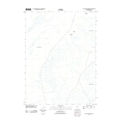
2011 Map of Salt Water Spring
USGS Topo · Published 2011About this map
The Jackson Mountains dominate the eastern reaches of this Great Basin landscape, where deep drainages like Black Canyon and Rattlesnake Canyon cut through the high ground. To the west, the arid expanse of the Black Rock Desert begins, a region defined by its lack of surface water and seasonal drainage patterns. Water is a rare and critical resource here, marked by isolated points such as Hot Spring and Butts Spring, as well as the seasonal flow of Jackson Creek Slough in the northwest. The presence of Jackson Creek Ranch Rd represents the primary human footprint, providing access through the basin-and-range topography. This 2011 survey captures a remote section of Humboldt County where the geography dictates land use, centered on the scarce springs that have historically sustained life in the high desert.
Find a feature on this map
9 named features on this map. Tap any name to fly to it.
Don’t see what you’re looking for? This feature index may not catch every label — zoom into the map to look around manually.
Map Details
Editions of this 2011 Salt Water Spring Map
This is the sole edition of this map. No revisions or reprints were ever made.
Other maps of this area

1886 · Disaster
USGS Topo · 1:250,000

1893 · Disaster
USGS Topo · 1:250,000

1931 · Lovelock
USGS Topo · 1:250,000

1935 · Lovelock
USGS Topo · 1:250,000

1954 · Vya
USGS Topo · 1:250,000

1955 · Lovelock
USGS Topo · 1:250,000

1958 · Vya
USGS Topo · 1:250,000

1959 · Lovelock
USGS Topo · 1:250,000

1962 · Vya
USGS Topo · 1:250,000

1966 · King Lear Peak
USGS Topo · 1:62,500