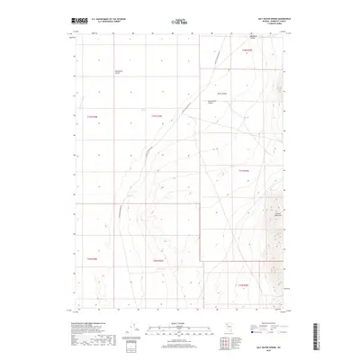
2018 Map of Salt Water Spring
USGS Topo · Published 2018About this map
Black Rock Desert dominates the western reaches of this landscape, where the flat, arid basin meets the rising slopes of the Jackson Mountains. This terrain transition is marked by a series of vital water sources that sustained early ranching and travel through the high desert, including Salt Water Spring, Hot Spring, and Butts Spring. The presence of Jackson Cr Slough at the foot of the mountains suggests a seasonal drainage pattern where water occasionally reaches the desert floor from higher elevations. The remote nature of this Humboldt County area is emphasized by the singular presence of Jackson Creek Ranch Rd, which winds through the central valley and navigates the breaks of Black Canyon and Rattlesnake Canyon. This survey captures a classic Great Basin environment where settlement and movement are dictated by the scarce proximity of springs and the steep canyons of the desert range.
Find a feature on this map
17 named features on this map. Tap any name to fly to it.
Don’t see what you’re looking for? This feature index may not catch every label — zoom into the map to look around manually.
Map Details
Editions of this 2018 Salt Water Spring Map
This is the sole edition of this map. No revisions or reprints were ever made.
Other maps of this area

1886 · Disaster
USGS Topo · 1:250,000

1893 · Disaster
USGS Topo · 1:250,000

1931 · Lovelock
USGS Topo · 1:250,000

1935 · Lovelock
USGS Topo · 1:250,000

1954 · Vya
USGS Topo · 1:250,000

1955 · Lovelock
USGS Topo · 1:250,000

1958 · Vya
USGS Topo · 1:250,000

1959 · Lovelock
USGS Topo · 1:250,000

1962 · Vya
USGS Topo · 1:250,000

1966 · King Lear Peak
USGS Topo · 1:62,500