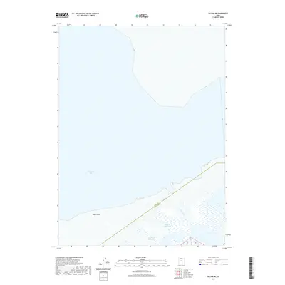
2020 Map of Saltair NE
USGS Topo · Published 2020About this map
Farmington Bay dominates this section of the Great Salt Lake shoreline, where the boundary between Davis County and Salt Lake County cuts through the marshy terrain. The landscape is defined by the hydrologic transition from the open waters of the bay to the eastern wetlands fed by Crystal Cr and the branching waters of Left Fork Spring Creek and Right Fork Spring Creek. Near the southern edge of the bay, Goose Island stands as a prominent terrain feature within the aquatic expanse. This 2020 survey illustrates the contemporary hydrological footprint of the region, providing a precise look at the drainage patterns and shoreline fluctuations that characterize this unique Great Basin environment.
Find a feature on this map
6 named features on this map. Tap any name to fly to it.
Don’t see what you’re looking for? This feature index may not catch every label — zoom into the map to look around manually.
Map Details
Editions of this 2020 Saltair NE Map
This is the sole edition of this map. No revisions or reprints were ever made.
Other maps of this area

1885 · Salt Lake
USGS Topo · 1:250,000

1885 · Tooele Valley
USGS Topo · 1:250,000

1925 · Ft. Douglas
USGS Topo · 1:125,000

1928 · Ft. Douglas
USGS Topo · 1:125,000

1951 · Saltair
USGS Topo · 1:24,000

1951 · Salt Lake City North
USGS Topo · 1:24,000

1952 · Saltair NE
USGS Topo · 1:24,000

1952 · Farmington
USGS Topo · 1:24,000

1952 · Antelope Island South
USGS Topo · 1:24,000

1953 · Tooele
USGS Topo · 1:250,000