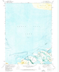
1972 Map of Saltair NE
USGS Topo · Published 1974About this map
Great Salt Lake dominates this orthophotomosaic, which utilizes aerial photography to reveal the complex, shifting interface between water and land along the shores of Farmington Bay. The imagery highlights the expansive stretches of Alkali or Mud that characterize the basin's edges, particularly around the Waterfowl Management Area. This conservation land is fed by several small waterways, including Crystal Creek, Left Fork Spring Cr, and Right Fork Spring Cr.
Find a feature on this map
12 named features on this map. Tap any name to fly to it.
Don’t see what you’re looking for? This feature index may not catch every label — zoom into the map to look around manually.
Map Details
Editions of this 1972 Saltair NE Map
This is the sole edition of this map. No revisions or reprints were ever made.
Other maps of this area

1885 · Salt Lake
USGS Topo · 1:250,000

1885 · Tooele Valley
USGS Topo · 1:250,000

1925 · Ft. Douglas
USGS Topo · 1:125,000

1928 · Ft. Douglas
USGS Topo · 1:125,000

1951 · Saltair
USGS Topo · 1:24,000

1951 · Salt Lake City North
USGS Topo · 1:24,000

1952 · Saltair NE
USGS Topo · 1:24,000

1952 · Farmington
USGS Topo · 1:24,000

1952 · Antelope Island South
USGS Topo · 1:24,000

1953 · Tooele
USGS Topo · 1:250,000