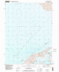
1997 Map of Saltair NE
USGS Topo · Published 2001About this map
Great Salt Lake dominates this coastal landscape where the waters of Farmington Bay meet the shoreline of Davis and Salt Lake counties. This late-twentieth-century environmental record highlights a complex hydrological and conservation network, including the Waterfowl Management Area and the Salt Lake City Sewage Canal. The presence of a Road on Levee underscores the engineering required to manage this transitional wetland environment, where the boundaries between land and water are often defined by extensive stretches of Mud.
Find a feature on this map
12 named features on this map. Tap any name to fly to it.
Don’t see what you’re looking for? This feature index may not catch every label — zoom into the map to look around manually.
Map Details
Editions of this 1997 Saltair NE Map
This is the sole edition of this map. No revisions or reprints were ever made.
Other maps of this area

1885 · Salt Lake
USGS Topo · 1:250,000

1885 · Tooele Valley
USGS Topo · 1:250,000

1925 · Ft. Douglas
USGS Topo · 1:125,000

1928 · Ft. Douglas
USGS Topo · 1:125,000

1951 · Saltair
USGS Topo · 1:24,000

1951 · Salt Lake City North
USGS Topo · 1:24,000

1952 · Saltair NE
USGS Topo · 1:24,000

1952 · Farmington
USGS Topo · 1:24,000

1952 · Antelope Island South
USGS Topo · 1:24,000

1953 · Tooele
USGS Topo · 1:250,000