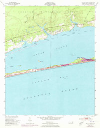
1951 Map of Salter Path
USGS Topo · Published 1973About this map
Bogue Banks stretches across this mid-century survey, separating the Atlantic Ocean from the expansive Bogue Sound. The barrier island shows early development at Emerald Isle and the established fishing village of Salter Path, while interior landmarks like Yellow Hill Landing and Rices Path hint at the local maritime history of the Outer Banks. North of the sound, the landscape is defined by the Croatan National Forest, where numerous drainage prongs like East Prong and West Prong feed into the Broad Creek estuary.
Find a feature on this map
37 named features on this map. Tap any name to fly to it.
Don’t see what you’re looking for? This feature index may not catch every label — zoom into the map to look around manually.
Map Details
Editions of this 1951 Salter Path Map
2 editions found
Other maps of this area

1942 · Maysville
USGS Topo · 1:62,500

1942 · Swansboro
USGS Topo · 1:62,500

1948 · Maysville
USGS Topo · 1:62,500

1948 · Swansboro
USGS Topo · 1:62,500

1949 · Newport
USGS Topo · 1:24,000

1949 · Salter Path
USGS Topo · 1:24,000

1949 · Mansfield
USGS Topo · 1:24,000

1949 · Masontown
USGS Topo · 1:24,000

1951 · Salter Path
USGS Topo · 1:24,000

1951 · Newport
USGS Topo · 1:24,000