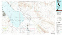
1985 Map of Salton Sea
USGS Topo · Published 1985About this map
Salton Sea dominates the landscape of the Imperial Valley in this mid-1980s record, surrounded by a complex network of military reservations, wildlife habitats, and desert mining operations. The map illustrates the significant human footprint on this arid basin, from the agricultural grids around Calipatria and Niland to the extensive Chocolate Mountain Aerial Gunnery Range to the east. Along the shoreline, recreational and ecological interests are represented by the Salton Sea State Recreation Area and the Salton Sea National Wildlife Refuge. The Southern Pacific railroad follows the eastern shore, passing through small settlements and sidings like Bombay Beach and Wister. Evidence of the region's mineral wealth is scattered across the Chocolate Mountains, with labeled sites such as the Black Eagle Mine and Mary Lode Mine marking the rugged interior. The map also identifies remote water sources like Chuckwalla Spring and Frink Spring, essential landmarks in the desert terrain.
Find a feature on this map
82 named features on this map. Tap any name to fly to it.
Don’t see what you’re looking for? This feature index may not catch every label — zoom into the map to look around manually.
Map Details
Editions of this 1985 Salton Sea Map
2 editions found
Other maps of this area

1903 · Yuma
USGS Topo · 1:125,000

1904 · Indio
USGS Topo · 1:125,000

1905 · Yuma
USGS Topo · 1:125,000

1907 · Holtville
USGS Topo · 1:125,000

1915 · El Centro
USGS Topo · 1:125,000

1931 · Vallecito
USGS Topo · 1:125,000

1931 · Carrizo
USGS Topo · 1:125,000

1940 · Brawley
USGS Topo · 1:62,500

1940 · Kane Spring
USGS Topo · 1:62,500

1940 · Iris
USGS Topo · 1:62,500