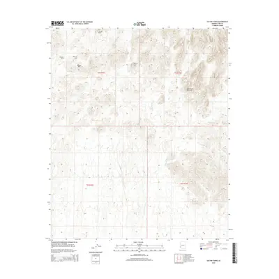
2014 Map of Salton Tanks
USGS Topo · Published 2014About this map
The Castle Dome Mountains dominate the landscape of this high-desert region in Yuma County, Arizona. This 2014 survey captures a terrain defined by stark geological formations and intermittent water sources, vital for understanding the historical movement through these arid lands. Notable landmarks include the prominent Thumb Butte and several instances of a Natural Arch, which serve as distinct navigational waypoints for those tracing old desert routes or mining claims.
Find a feature on this map
10 named features on this map. Tap any name to fly to it.
Don’t see what you’re looking for? This feature index may not catch every label — zoom into the map to look around manually.
Map Details
Editions of this 2014 Salton Tanks Map
This is the sole edition of this map. No revisions or reprints were ever made.
Other maps of this area

1928 · Norton
USGS Topo · 1:62,500

1929 · Norton
USGS Topo · 1:62,500

1942 · Yuma
USGS Topo · 1:250,000

1942 · Blythe
USGS Topo · 1:250,000

1942 · Vicksburg
USGS Topo · 1:250,000

1953 · Ajo
USGS Topo · 1:250,000

1954 · El Centro
USGS Topo · 1:250,000

1954 · Salton Sea
USGS Topo · 1:250,000

1954 · Phoenix
USGS Topo · 1:250,000

1955 · Salton Sea
USGS Topo · 1:250,000