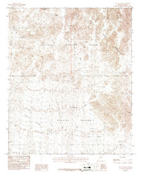
1986 Map of Salton Tanks
USGS Topo · Published 1986About this map
The Kofa National Wildlife Refuge and the northern reaches of the Yuma Proving Ground meet in this 1980s topographic study of the Arizona desert. The landscape is defined by the sharp transition between the elevated Kofa Mountains and the sweeping Castle Dome Plain. Human activity in this arid environment is recorded through a network of Mine Shaft and Prospects labels, marking the region's history of mineral exploration near Natural Arch.
Find a feature on this map
19 named features on this map. Tap any name to fly to it.
Don’t see what you’re looking for? This feature index may not catch every label — zoom into the map to look around manually.
Map Details
Editions of this 1986 Salton Tanks Map
This is the sole edition of this map. No revisions or reprints were ever made.
Other maps of this area

1928 · Norton
USGS Topo · 1:62,500

1929 · Norton
USGS Topo · 1:62,500

1942 · Yuma
USGS Topo · 1:250,000

1942 · Blythe
USGS Topo · 1:250,000

1942 · Vicksburg
USGS Topo · 1:250,000

1953 · Ajo
USGS Topo · 1:250,000

1954 · El Centro
USGS Topo · 1:250,000

1954 · Salton Sea
USGS Topo · 1:250,000

1954 · Phoenix
USGS Topo · 1:250,000

1955 · Salton Sea
USGS Topo · 1:250,000