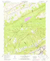
1958 Map of Saltville
USGS Topo · Published 1978About this map
Industrial and agricultural landscapes intersect at Saltville during the mid-to-late twentieth century. The North Fork Holston River serves as a geographic anchor, bordered by the operations of the Olin Mathieson Chemical Corp RR and numerous salt wells that define the town's historic economic base. Moving north from the valley floor, the terrain rises into the Clinch Mountain range, where the Jefferson National Forest and the Laurel Bed Wildlife Mgmt Area preserve large tracts of woodland.
Find a feature on this map
102 named features on this map. Tap any name to fly to it.
Don’t see what you’re looking for? This feature index may not catch every label — zoom into the map to look around manually.
Map Details
Editions of this 1958 Saltville Map
4 editions found
Other maps of this area

1891 · Tazewell
USGS Topo · 1:125,000

1891 · Abingdon
USGS Topo · 1:125,000

1894 · Abingdon
USGS Topo · 1:125,000

1895 · Tazewell
USGS Topo · 1:125,000

1897 · Tazewell
USGS Topo · 1:125,000

1909 · Abingdon
USGS Topo · 1:96,000

1911 · Abingdon
USGS Topo · 1:125,000

1912 · Pounding Mill
USGS Topo · 1:62,500

1915 · Richlands
USGS Topo · 1:48,000

1916 · Pounding Mill
USGS Topo · 1:62,500