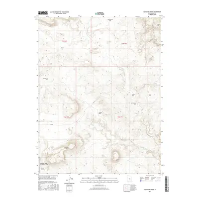
2017 Map of Salvation Creek
USGS Topo · Published 2017About this map
Capitol Reef National Park occupies the southwestern corner of this quadrangle, where the arid landscape transitions into the Middle Desert. The topography is defined by significant elevation changes, ranging from the low-lying Mussentuchit Flat in the north to the prominent summit of Factory Butte in the south. This area of Emery County is characterized by a complex drainage system including Salvation Cr, Temple Wash, and Carlyle Wash, which have carved out the distinct geological formations shown here.
Find a feature on this map
18 named features on this map. Tap any name to fly to it.
Don’t see what you’re looking for? This feature index may not catch every label — zoom into the map to look around manually.
Map Details
Editions of this 2017 Salvation Creek Map
This is the sole edition of this map. No revisions or reprints were ever made.
Other maps of this area

1885 · Fish Lake
USGS Topo · 1:250,000

1896 · Fish Lake
USGS Topo · 1:250,000

1952 · Notom 2 NE
USGS Topo · 1:24,000

1952 · Torrey
USGS Topo · 1:62,500

1953 · Emery 4 NE
USGS Topo · 1:24,000

1953 · Emery 4 SE
USGS Topo · 1:24,000

1954 · Notom 1 NE
USGS Topo · 1:24,000

1954 · Fruita
USGS Topo · 1:62,500
1954 · Notom 1 NW
USGS Topo · 1:24,000

1956 · Salina
USGS Topo · 1:250,000