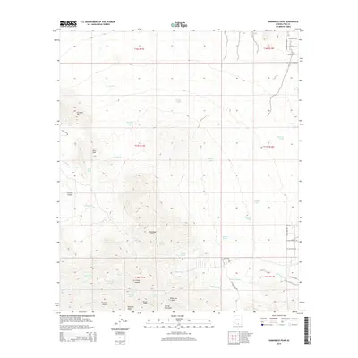
2014 Map of Samaniego Peak
USGS Topo · Published 2014About this map
The Sierrita Mountains define this landscape south of the S Mcgee Ranch RD area, where a cluster of prominent summits rises sharply from the surrounding desert washes. High points such as Samaniego Peak, Soto Peak, and Gunsight Mtn are connected by a network of steep drainages, including Fresnal Canyon and Ox Frame Canyon. This arid environment is marked by an extensive system of man-made tanks and natural springs, such as Green Tanks, Broke Tanks, and Grays Spring, which indicate the critical infrastructure required for cattle ranching in the Pima County backcountry. The southeastern portion of the map shows modern residential development branching into the foothills with names like Iron Door Dr and Lost Emerald Ln, contrasting with the more primitive canyon routes of Tascuela Wash and Tinaja Wash to the west.
Find a feature on this map
55 named features on this map. Tap any name to fly to it.
Don’t see what you’re looking for? This feature index may not catch every label — zoom into the map to look around manually.
Map Details
Editions of this 2014 Samaniego Peak Map
This is the sole edition of this map. No revisions or reprints were ever made.
Other maps of this area

1920 · Arivaca
USGS Topo · 1:125,000

1925 · Samaniego Peak
USGS Topo · 1:62,500

1925 · San Xavier
USGS Topo · 1:62,500

1934 · Tucson Mountains
USGS Topo · 1:125,000

1939 · Twin Buttes
USGS Topo · 1:62,500

1940 · Palo Alto Ranch
USGS Topo · 1:62,500

1941 · Twin Buttes
USGS Topo · 1:62,500

1941 · Cocoraque Butte
USGS Topo · 1:62,500

1943 · Cocoraque Butte
USGS Topo · 1:62,500

1943 · Palo Alto Ranch
USGS Topo · 1:62,500