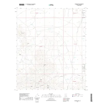
2018 Map of Samaniego Peak
USGS Topo · Published 2018About this map
Samaniego Peak and the high ridges of the Sierrita Mountains anchor this arid landscape in Pima County. The terrain is marked by a complex network of drainage washes such as Fresnal Wash, Soto Wash, and Esperanza Wash, which flow from deep incisions like Fresnal Canyon and Ox Frame Canyon. In an environment where water is the primary challenge, numerous stock tanks and improved water sources are recorded, including Zapeda-Tank, Green Tanks, and Broke Tanks.
Find a feature on this map
55 named features on this map. Tap any name to fly to it.
Don’t see what you’re looking for? This feature index may not catch every label — zoom into the map to look around manually.
Map Details
Editions of this 2018 Samaniego Peak Map
This is the sole edition of this map. No revisions or reprints were ever made.
Other maps of this area

1920 · Arivaca
USGS Topo · 1:125,000

1925 · Samaniego Peak
USGS Topo · 1:62,500

1925 · San Xavier
USGS Topo · 1:62,500

1934 · Tucson Mountains
USGS Topo · 1:125,000

1939 · Twin Buttes
USGS Topo · 1:62,500

1940 · Palo Alto Ranch
USGS Topo · 1:62,500

1941 · Twin Buttes
USGS Topo · 1:62,500

1941 · Cocoraque Butte
USGS Topo · 1:62,500

1943 · Cocoraque Butte
USGS Topo · 1:62,500

1943 · Palo Alto Ranch
USGS Topo · 1:62,500