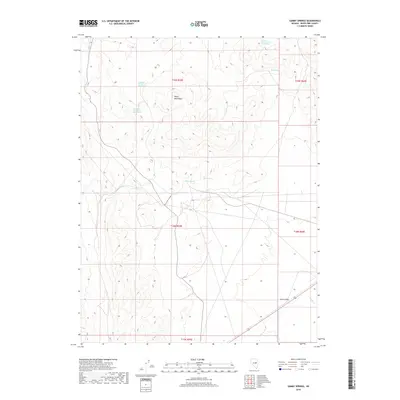
2018 Map of Sammy Springs
USGS Topo · Published 2018About this map
Butte Mountains dominate the high terrain of this Nevada interior, providing a stark vertical contrast to the broad expanse of Jakes Valley in the southeast. The 2018 landscape is defined by its scarce but vital water sources, including the namesake Sammy Springs, Indian Spring, and the curiously named Robbers Roost Number Two Spring.
Find a feature on this map
16 named features on this map. Tap any name to fly to it.
Don’t see what you’re looking for? This feature index may not catch every label — zoom into the map to look around manually.
Map Details
Editions of this 2018 Sammy Springs Map
This is the sole edition of this map. No revisions or reprints were ever made.
Other maps of this area

1951 · Illipah
USGS Topo · 1:62,500

1956 · Ely
USGS Topo · 1:250,000

1959 · Ely
USGS Topo · 1:250,000

1959 · Reipetown
USGS Topo · 1:62,500

1963 · Ely
USGS Topo · 1:250,000

1979 · Mt. Hamilton
USGS Topo · 1:100,000

1982 · Dickenson Well
USGS Topo · 1:24,000

1982 · Sunshine Well
USGS Topo · 1:24,000
1982 · Thirtymile Ranch
USGS Topo · 1:24,000

1985 · Newark Lake
USGS Topo · 1:100,000