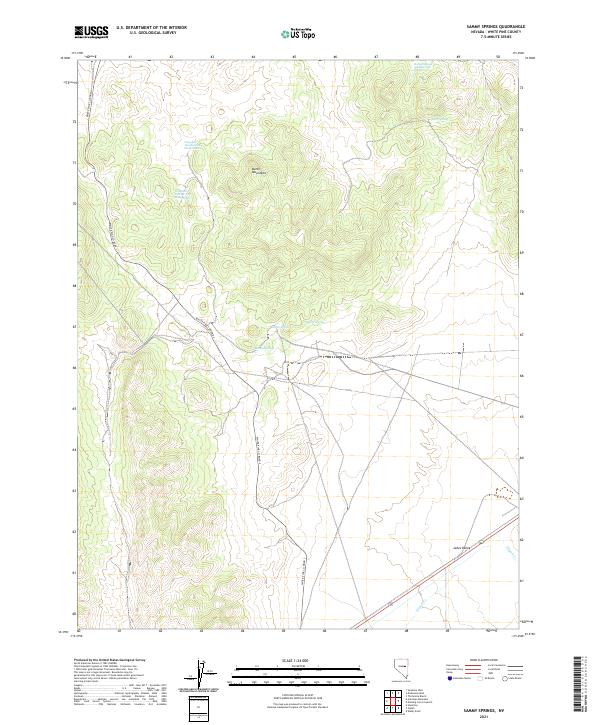
2021 Map of Sammy Springs
USGS Topo · Published 2021About this map
Butte Mountains dominate this high-desert landscape in White Pine County, showing a region defined by critical water sources and livestock range management. The presence of Campbell Number One Sheep Swan and Campbell Number Two Sheep Swan indicates the historical importance of the sheep-herding industry in these basins. Numerous water points, including Robbers Roost Number Two Spring, Sammy Springs, and Indian Spring, are scattered across the terrain, serving as vital landmarks for those traversing the dry valleys. In the southeastern reaches, the terrain descends toward Jakes Valley, where Illipah Cr. flows. The area remains accessible via White Pine Co Road 3, which cuts through the heart of the township and range divisions, connecting isolated springs like Willow Spring to the broader regional network.
Find a feature on this map
16 named features on this map. Tap any name to fly to it.
Don’t see what you’re looking for? This feature index may not catch every label — zoom into the map to look around manually.
Map Details
Editions of this 2021 Sammy Springs Map
This is the sole edition of this map. No revisions or reprints were ever made.
Other maps of this area

1951 · Illipah
USGS Topo · 1:62,500

1956 · Ely
USGS Topo · 1:250,000

1959 · Ely
USGS Topo · 1:250,000

1959 · Reipetown
USGS Topo · 1:62,500

1963 · Ely
USGS Topo · 1:250,000

1979 · Mt. Hamilton
USGS Topo · 1:100,000

1982 · Dickenson Well
USGS Topo · 1:24,000

1982 · Sunshine Well
USGS Topo · 1:24,000
1982 · Thirtymile Ranch
USGS Topo · 1:24,000

1985 · Newark Lake
USGS Topo · 1:100,000