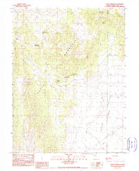
1990 Map of Sammy Springs
USGS Topo · Published 1990About this map
The Butte Mountains dominate this central Nevada landscape, which is defined by high-desert terrain and the vital presence of scattered water sources. In 1990, the region supported cattle ranching and light resource extraction, evidenced by the Stock Tank and Stock Pond locations alongside a Gravel Pit and scattered Prospect sites. The mapping of Sammy Springs and several others, such as Robbers Roost No 2 Spring and Deer Spring, highlights the critical importance of these water points for land use in White Pine County. To the east, the terrain drops into Jakes Valley, where Illipah Creek provides a seasonal drainage route. Named mining-related landmarks like Campbell No 1 and Campbell No 2 Sheep Swan suggest a history of localized exploration in the foothills of the Butte range.
Find a feature on this map
22 named features on this map. Tap any name to fly to it.
Don’t see what you’re looking for? This feature index may not catch every label — zoom into the map to look around manually.
Map Details
Editions of this 1990 Sammy Springs Map
This is the sole edition of this map. No revisions or reprints were ever made.
Other maps of this area

1951 · Illipah
USGS Topo · 1:62,500

1956 · Ely
USGS Topo · 1:250,000

1959 · Ely
USGS Topo · 1:250,000

1959 · Reipetown
USGS Topo · 1:62,500

1963 · Ely
USGS Topo · 1:250,000

1979 · Mt. Hamilton
USGS Topo · 1:100,000

1982 · Dickenson Well
USGS Topo · 1:24,000

1982 · Sunshine Well
USGS Topo · 1:24,000
1982 · Thirtymile Ranch
USGS Topo · 1:24,000

1985 · Newark Lake
USGS Topo · 1:100,000