
2022 Map of Sampson
USGS Topo · Published 2022About this map
The Plateau country of Middle Tennessee is defined here by the high elevations of Salzer Mtn and the deep drainage of Cane Creek. The small settlements of Mooneyham and Sampson serve as focal points for a landscape marked by long-standing family ties, evidenced by the Mooneyham Cem, Walling Cem, and Debord Cem. The terrain transitions from the heights of Pilot Ridge and Bear Pan Ridge down into the narrow hollows of Walling Mill Cr and Johnnie Br. This modern survey illustrates a network of ridgeline roads and winding trails, such as Camps Gulf Trl and High Rock Trl, which navigate the steep drops near Buzzards Roost. The presence of Pine Lake and the various branches feeding into Glade Creek highlight the intricate hydrology of the Van Buren Co and Bledsoe Co borderlands.
Find a feature on this map
127 named features on this map. Tap any name to fly to it.
Don’t see what you’re looking for? This feature index may not catch every label — zoom into the map to look around manually.
Map Details
Editions of this 2022 Sampson Map
This is the sole edition of this map. No revisions or reprints were ever made.
Other maps of this area

1892 · Pikeville
USGS Topo · 1:125,000

1895 · Pikeville
USGS Topo · 1:125,000

1909 · Sequatchie Valley
USGS Topo · 1:62,500

1910 · Pikeville
USGS Topo · 1:62,500

1912 · Crossville
USGS Topo · 1:62,500

1935 · Brockdell
USGS Topo · 1:24,000

1935 · Billingsley Gap
USGS Topo · 1:24,000
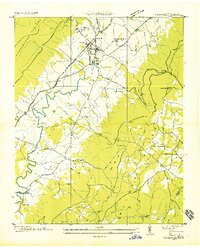
1935 · Pikeville
USGS Topo · 1:24,000

1935 · Smart Mountain
USGS Topo · 1:24,000

1943 · Cookeville
USGS Topo · 1:100,000