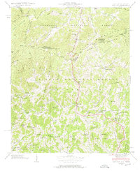
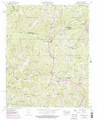
1939 Map of Sams Gap
USGS Topo · Published 1975About this map
Sams Gap and Street Gap punctuate the high ridges along the North Carolina and Tennessee border, marking the steep crossings of the Bald Mountains during the late 1930s. This survey by Fairchild Aerial Surveys reveals a high-elevation landscape where small agricultural communities and family settlements are tucked into the narrow hollows of the Walnut Mountains and Pisgah National Forest. The distribution of family cemeteries like the Shelton Cem and Engle Cem, alongside rural social hubs like Halls Store and the Shady Grove Sch, illustrates the tight-knit nature of these upland mountain pockets.
Find a feature on this map
97 named features on this map. Tap any name to fly to it.
Don’t see what you’re looking for? This feature index may not catch every label — zoom into the map to look around manually.
Map Details
Editions of this 1939 Sams Gap Map
5 editions found
Other maps of this area

1891 · Roan Mountain
USGS Topo · 1:125,000

1892 · Greeneville
USGS Topo · 1:125,000

1894 · Asheville
USGS Topo · 1:125,000

1894 · Roan Mountain
USGS Topo · 1:125,000

1896 · Greeneville
USGS Topo · 1:125,000

1900 · Mount Mitchell
USGS Topo · 1:125,000

1901 · Asheville
USGS Topo · 1:125,000

1902 · Mount Mitchell
USGS Topo · 1:125,000

1904 · Roan Mountain
USGS Topo · 1:125,000

1904 · Greeneville
USGS Topo · 1:125,000