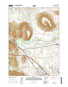
2017 Map of Sams Valley
USGS Topo · Published 2017About this map
Sams Valley and the surrounding Jackson County landscape appear here in a detailed survey that captures the area's intricate water management and agricultural infrastructure. The topography is dominated by the striking profiles of Upper Table Rock and Lower Table Rock, which overlook the Rogue River and the sprawling Agate Desert. This 2017 study illustrates a sophisticated network of irrigation and storage, including the Hopkins Canal, Upton Lateral, and Coker Butte Lateral, alongside numerous private impoundments like Lester James Reservoir Number 3 and Koellner Reservoir. The transition from rural valley to urban edge is clear near Central Point, where modern infrastructure such as the Rogue Valley International - Medford Airport meets historical markers like the Central Point IOOF Cem. Genealogists will find value in the specific naming of small settlements like Seven Oaks and family-named landmarks such as Bommers Flat and Holman Gulch.
Find a feature on this map
78 named features on this map. Tap any name to fly to it.
Don’t see what you’re looking for? This feature index may not catch every label — zoom into the map to look around manually.
Map Details
Editions of this 2017 Sams Valley Map
This is the sole edition of this map. No revisions or reprints were ever made.
Other maps of this area

1891 · Ashland
USGS Topo · 1:250,000

1893 · Ashland
USGS Topo · 1:250,000

1897 · Ashland
USGS Topo · 1:250,000

1904 · Riddle
USGS Topo · 1:125,000

1908 · Grants Pass
USGS Topo · 1:125,000

1938 · Medford
USGS Topo · 1:125,000

1943 · Trail
USGS Topo · 1:62,500

1954 · Medford
USGS Topo · 1:62,500

1954 · Gold Hill
USGS Topo · 1:62,500

1954 · Wimer
USGS Topo · 1:62,500