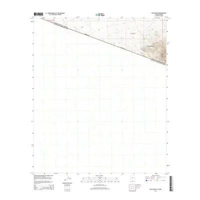
2014 Map of San Agustin
USGS Topo · Published 2014About this map
San Agustin sits near the international border in this 2014 topographic study of southern Pima County. The landscape is dominated by the steep rises of Morena Mtn and Horse Peak, which anchor the southeastern corner of the quadrangle. Most of the terrain is defined by the dramatic diagonal line separating the United States and Mexico, a boundary that fundamentally dictates the region's geography and land use. The map illustrates a stark transition from the high, rocky elevations in the east to the expansive, lower desert plains that stretch toward the western horizon. Beyond the primary settlement and peaks, the survey records the intricate network of natural drainages that carve through the desert floor, reflecting the arid environment's hydrology.
Find a feature on this map
8 named features on this map. Tap any name to fly to it.
Don’t see what you’re looking for? This feature index may not catch every label — zoom into the map to look around manually.
Map Details
Editions of this 2014 San Agustin Map
This is the sole edition of this map. No revisions or reprints were ever made.
Other maps of this area

1941 · Vamori
USGS Topo · 1:62,500

1943 · Fresnal
USGS Topo · 1:125,000

1943 · Vamori
USGS Topo · 1:62,500

1954 · Sonoyta
USGS Topo · 1:250,000

1956 · Nogales
USGS Topo · 1:250,000

1958 · Nogales
USGS Topo · 1:250,000

1959 · Nogales
USGS Topo · 1:250,000
1963 · La Lesna Mts.
USGS Topo · 1:62,500

1963 · Lukeville
USGS Topo · 1:250,000
1979 · San Miguel
USGS Topo · 1:24,000