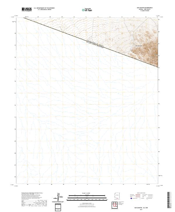
2021 Map of San Agustin
USGS Topo · Published 2021About this map
The international border between the United States of America and Estados Unidos Mexicanos cuts diagonally across the northern portion of this map, marking the edge of Pima County. The terrain is characterized by the rising elevations of the Comobabi Mountains, where Horse Peak and Morena Mtn dominate the landscape just south of the settlement at San Agustin. This modern survey illustrates the proximity of these prominent peaks to the border, providing a clear view of the topographical transition from the lower desert floor to the rugged heights of the southern Arizona mountains. The sparsely populated area centers on the crossroads at San Agustin, with the land divisions of t21s r4e and t21s r5e defining the regional survey grid.
Find a feature on this map
7 named features on this map. Tap any name to fly to it.
Don’t see what you’re looking for? This feature index may not catch every label — zoom into the map to look around manually.
Map Details
Editions of this 2021 San Agustin Map
This is the sole edition of this map. No revisions or reprints were ever made.
Other maps of this area

1941 · Vamori
USGS Topo · 1:62,500

1943 · Fresnal
USGS Topo · 1:125,000

1943 · Vamori
USGS Topo · 1:62,500

1954 · Sonoyta
USGS Topo · 1:250,000

1956 · Nogales
USGS Topo · 1:250,000

1958 · Nogales
USGS Topo · 1:250,000

1959 · Nogales
USGS Topo · 1:250,000
1963 · La Lesna Mts.
USGS Topo · 1:62,500

1963 · Lukeville
USGS Topo · 1:250,000
1979 · San Miguel
USGS Topo · 1:24,000