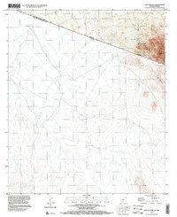
1996 Map of San Agustin
USGS Topo · Published 2003About this map
The international border between the United States of America and Mexico bisects this 1990s survey, illustrating the cross-border landscape where Pima County meets Sonora. Much of the northern terrain is occupied by the Tohono O'odham Indian Reservation, a region defined by its arid basins and the prominent rise of Morena Mountain. Small outposts like El Represito and the southern C. Jacobo suggest the sparse, isolated nature of settlement in this desert corridor.
Find a feature on this map
10 named features on this map. Tap any name to fly to it.
Don’t see what you’re looking for? This feature index may not catch every label — zoom into the map to look around manually.
Map Details
Editions of this 1996 San Agustin Map
This is the sole edition of this map. No revisions or reprints were ever made.
Other maps of this area

1941 · Vamori
USGS Topo · 1:62,500

1943 · Fresnal
USGS Topo · 1:125,000

1943 · Vamori
USGS Topo · 1:62,500

1954 · Sonoyta
USGS Topo · 1:250,000

1956 · Nogales
USGS Topo · 1:250,000

1958 · Nogales
USGS Topo · 1:250,000

1959 · Nogales
USGS Topo · 1:250,000
1963 · La Lesna Mts.
USGS Topo · 1:62,500

1963 · Lukeville
USGS Topo · 1:250,000
1979 · San Miguel
USGS Topo · 1:24,000