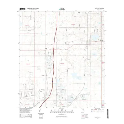
2015 Map of San Antonio
USGS Topo · Published 2015About this map
San Antonio and the campus of Saint Leo University anchor this eastern Pasco County landscape, revealing a pattern of clustered settlements and agricultural open space. The terrain is defined by low-lying wetlands and numerous water bodies, including King Lake, Dick Lake, and the expansive Thomas Prairie. These natural features are interspersed with several small communities such as Darby, Saint Joseph, and the railroad-adjacent village of Pasco.
Find a feature on this map
162 named features on this map. Tap any name to fly to it.
Don’t see what you’re looking for? This feature index may not catch every label — zoom into the map to look around manually.
Map Details
Editions of this 2015 San Antonio Map
This is the sole edition of this map. No revisions or reprints were ever made.
Other maps of this area

1943 · Lutz
USGS Topo · 1:24,000

1944 · Wesley Chapel
USGS Topo · 1:31,680

1944 · Lutz
USGS Topo · 1:31,680

1947 · Zephyrhills
USGS Topo · 1:24,000

1954 · Spring Lake
USGS Topo · 1:24,000

1954 · Ehren
USGS Topo · 1:24,000

1954 · San Antonio
USGS Topo · 1:24,000

1954 · Masaryktown
USGS Topo · 1:24,000

1955 · Plant City
USGS Topo · 1:250,000

1958 · Plant City
USGS Topo · 1:250,000