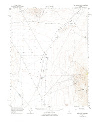
1964 Map of San Antonio Ranch
USGS Topo · Published 1977About this map
The San Antonio Mountains rise sharply over the eastern edge of this landscape, marked by a concentrated mining district that includes the San Antonio Mine, Hall Mine, and Liberty Mine. These operations, along with nearby Liberty Springs, point to the industrial activity that defined this high desert region in the mid-20th century. To the west, the basin of Big Smoky Valley dominates the terrain, featuring expansive Sand Dunes and the prominent Crescent Dunes.
Find a feature on this map
16 named features on this map. Tap any name to fly to it.
Don’t see what you’re looking for? This feature index may not catch every label — zoom into the map to look around manually.
Map Details
Editions of this 1964 San Antonio Ranch Map
2 editions found
Other maps of this area

1907 · Tonopah
USGS Topo · 1:250,000

1908 · Tonopah
USGS Topo · 1:250,000

1956 · Tonopah
USGS Topo · 1:250,000

1959 · Tonopah
USGS Topo · 1:250,000

1961 · Tonopah
USGS Topo · 1:62,500

1961 · Lone Mtn
USGS Topo · 1:62,500

1962 · Tonopah
USGS Topo · 1:250,000

1963 · Baxter Spring
USGS Topo · 1:62,500

1964 · San Antonio Ranch
USGS Topo · 1:62,500
1968 · Crow Springs
USGS Topo · 1:24,000