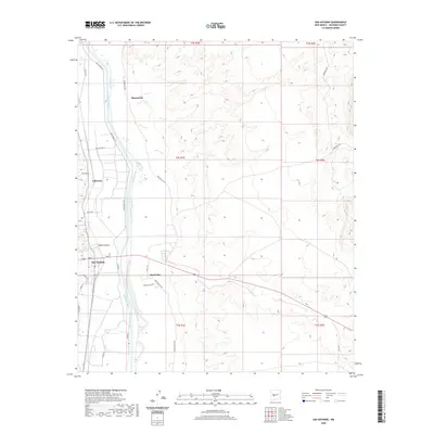
2020 Map of San Antonio
USGS Topo · Published 2020About this map
Rio Grande waters define this Socorro County landscape, where an intricate system of irrigation channels like the San Antonio Ditch and Elmendorf Ditch supports agricultural life in the desert. The settlement of San Antonio serves as a local hub, situated near the confluence of Walnut Creek and the river valley. To the north, the small communities of Laborcita and Bosquecito line the western and eastern banks respectively, illustrating a historic pattern of riverside habitation. The topography shifts abruptly from the fertile floodplain to the eastern high ground, dissected by Nogal Canyon and the San Pedro Arroyo. Further east, a network of tracks such as Quebradas Rd and Guadalajara Rd provides access to the arid interior, while Farm Market Rd remains the primary artery for the valley's transport.
Find a feature on this map
34 named features on this map. Tap any name to fly to it.
Don’t see what you’re looking for? This feature index may not catch every label — zoom into the map to look around manually.
Map Details
Editions of this 2020 San Antonio Map
This is the sole edition of this map. No revisions or reprints were ever made.
Other maps of this area

1906 · Socorro
USGS Topo · 1:62,500

1916 · La Joya
USGS Topo · 1:125,000

1948 · Carthage
USGS Topo · 1:62,500

1948 · San Antonio
USGS Topo · 1:62,500

1954 · Tularosa
USGS Topo · 1:250,000

1954 · Socorro
USGS Topo · 1:250,000

1958 · Socorro
USGS Topo · 1:250,000

1958 · Tularosa
USGS Topo · 1:250,000

1959 · Loma De Las Canas
USGS Topo · 1:24,000

1959 · Socorro
USGS Topo · 1:24,000