
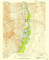
1948 Map of San Antonio
USGS Topo · Published 1954About this map
The Rio Grande corridor in central New Mexico is the focal point of this late-1940s survey, dominated by the expansive Bosque Del Apache Migratory Waterfowl Refuge. The river valley acts as a narrow band of irrigation and settlement between the Chupadera Mountains to the west and the high desert plains to the east. Along the Atchison Topeka and Santa Fe railroad line, the village of San Antonio and the nearby San Pedro represent the primary centers of commerce and residence.
Find a feature on this map
34 named features on this map. Tap any name to fly to it.
Don’t see what you’re looking for? This feature index may not catch every label — zoom into the map to look around manually.
Map Details
Editions of this 1948 San Antonio Map
2 editions found
Other maps of this area

1906 · Socorro
USGS Topo · 1:62,500

1916 · La Joya
USGS Topo · 1:125,000

1948 · Carthage
USGS Topo · 1:62,500

1948 · Granjean Well
USGS Topo · 1:62,500

1948 · Val Verde
USGS Topo · 1:62,500

1954 · Tularosa
USGS Topo · 1:250,000

1954 · Socorro
USGS Topo · 1:250,000

1958 · Socorro
USGS Topo · 1:250,000

1958 · Tularosa
USGS Topo · 1:250,000

1959 · Loma De Las Canas
USGS Topo · 1:24,000