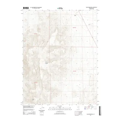
2014 Map of San Antonio Well
USGS Topo · Published 2014About this map
San Antonio Well serves as a vital historical point of reference in this arid stretch of Nye County, where the high desert meets the northern slopes of the San Antonio Mountains. The landscape is dominated by the steep topography of the range, including the prominent San Antonio Mtn, which towers over the western portion of the quadrangle. To the northeast, the terrain levels out into the Ralston Desert, reflecting the classic Basin and Range geography of central Nevada. This 2014 survey captures the region's isolated character, where land management is defined by the Public Land Survey System grids of t6n r42e, t6n r43e, and the townships to the south, highlighting the sparse infrastructure typical of the Nevada interior.
Find a feature on this map
8 named features on this map. Tap any name to fly to it.
Don’t see what you’re looking for? This feature index may not catch every label — zoom into the map to look around manually.
Map Details
Editions of this 2014 San Antonio Well Map
This is the sole edition of this map. No revisions or reprints were ever made.
Other maps of this area

1907 · Tonopah
USGS Topo · 1:250,000

1908 · Tonopah
USGS Topo · 1:250,000

1956 · Tonopah
USGS Topo · 1:250,000

1959 · Tonopah
USGS Topo · 1:250,000

1961 · Tonopah
USGS Topo · 1:62,500

1961 · Lone Mtn
USGS Topo · 1:62,500

1962 · Tonopah
USGS Topo · 1:250,000

1963 · Baxter Spring
USGS Topo · 1:62,500

1964 · San Antonio Ranch
USGS Topo · 1:62,500
1987 · Henrys Well
USGS Topo · 1:24,000