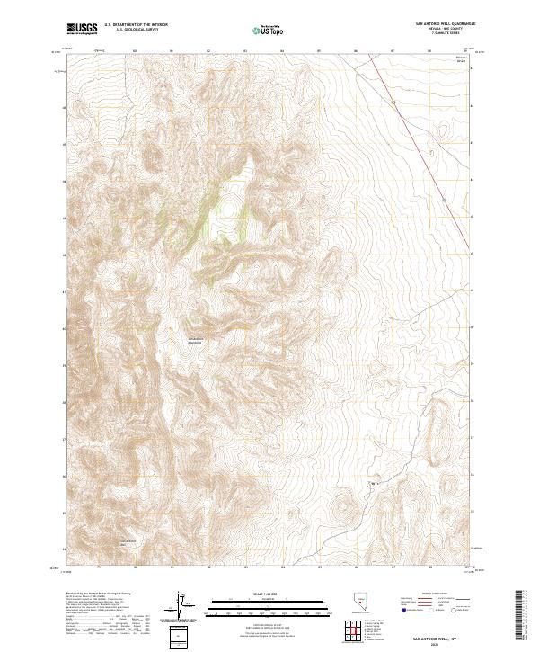
2021 Map of San Antonio Well
USGS Topo · Published 2021About this map
The San Antonio Mountains dominate this central Nevada landscape, rising sharply from the surrounding basins. This 2021 survey focuses on the rugged southern portion of the range, including the prominent summit of San Antonio Mtn. To the northeast, the terrain levels out into the Ralston Desert, a vast arid expanse typical of the Great Basin's endorheic topography. The map detail is primarily focused on the physical elevation and township boundaries of the region, including t6n r42e and t5n r43e. A single primary transportation corridor, State Route 376, skirts the eastern edge of the mountains, providing the only paved access through this sparse section of Nye County.
Find a feature on this map
8 named features on this map. Tap any name to fly to it.
Don’t see what you’re looking for? This feature index may not catch every label — zoom into the map to look around manually.
Map Details
Editions of this 2021 San Antonio Well Map
This is the sole edition of this map. No revisions or reprints were ever made.
Other maps of this area

1907 · Tonopah
USGS Topo · 1:250,000

1908 · Tonopah
USGS Topo · 1:250,000

1956 · Tonopah
USGS Topo · 1:250,000

1959 · Tonopah
USGS Topo · 1:250,000

1961 · Tonopah
USGS Topo · 1:62,500

1961 · Lone Mtn
USGS Topo · 1:62,500

1962 · Tonopah
USGS Topo · 1:250,000

1963 · Baxter Spring
USGS Topo · 1:62,500

1964 · San Antonio Ranch
USGS Topo · 1:62,500
1987 · Henrys Well
USGS Topo · 1:24,000