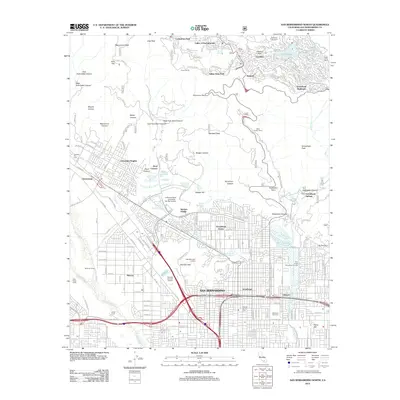
2012 Map of San Bernardino North
USGS Topo · Published 2012About this map
San Bernardino and its northern suburban reaches meet the San Bernardino National Forest in this detailed 2012 study. The urban grid extends north past California State University - San Bernardino and the Shandin Hills, where residential developments like Verdemont and Muscoy give way to the steep canyons of the Front Range. The map illustrates a complex water management system designed to handle the region's flash flood risks and water needs, featuring the Muscovy Levee and numerous percolation basins such as the Sweetwater Percolation Basin and Twin Creek Spreading Grounds.
Find a feature on this map
125 named features on this map. Tap any name to fly to it.
Don’t see what you’re looking for? This feature index may not catch every label — zoom into the map to look around manually.
Map Details
Editions of this 2012 San Bernardino North Map
This is the sole edition of this map. No revisions or reprints were ever made.
Other maps of this area

1896 · San Bernardino
USGS Topo · 1:62,500

1898 · San Bernardino
USGS Topo · 1:62,500

1899 · Redlands
USGS Topo · 1:62,500

1901 · Southern California Sheet No. 1
USGS Topo · 1:250,000

1901 · San Bernardino
USGS Topo · 1:62,500

1901 · Redlands
USGS Topo · 1:62,500

1902 · Deep Creek
USGS Topo · 1:62,500

1902 · Hesperia
USGS Topo · 1:62,500

1904 · Southern California Sheet No. 1
USGS Topo · 1:250,000

1936 · Devore
USGS Topo · 1:31,680