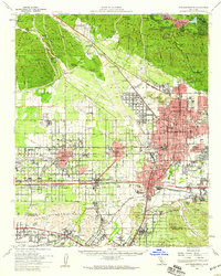
1954 Map of San Bernardino
USGS Topo · Published 1959About this map
San Bernardino and its neighboring communities are captured in a moment of significant mid-century expansion, revealing the intricate web of irrigation, rail, and early highway development in the Inland Empire. The landscape transitions from the developed grids of Fontana and Rialto to the steep slopes of the San Bernardino Mountains, where settlements like the Valley of Enchantment and Arrowhead Highlands offer a contrast to the industrial character of the valley floor. The map highlights the area's role as a major transportation hub, showing the convergence of the Atchison Topeka and Santa Fe RR, Union Pacific RR, and the Pacific Electric RR.
Find a feature on this map
109 named features on this map. Tap any name to fly to it.
Don’t see what you’re looking for? This feature index may not catch every label — zoom into the map to look around manually.
Map Details
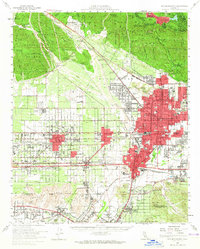
Editions of this 1954 San Bernardino Map
2 editions found
Other maps of this area

1896 · San Bernardino
USGS Topo · 1:62,500

1897 · Cucamonga
USGS Topo · 1:62,500

1898 · San Bernardino
USGS Topo · 1:62,500

1899 · Redlands
USGS Topo · 1:62,500

1900 · Cucamonga
USGS Topo · 1:62,500

1901 · Southern California Sheet No. 1
USGS Topo · 1:250,000

1901 · San Bernardino
USGS Topo · 1:62,500

1901 · Redlands
USGS Topo · 1:62,500

1901 · Elsinore
USGS Topo · 1:125,000

1901 · Riverside
USGS Topo · 1:62,500