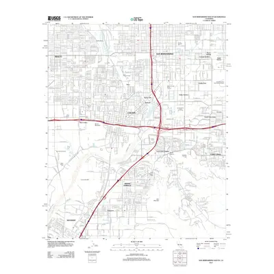
2012 Map of San Bernardino South
USGS Topo · Published 2012About this map
The Santa Ana River valley serves as the central artery for this complex network of early 21st-century Southern California communities. The landscape is defined by its industrial and agricultural water infrastructure, notably the Riverside Canal, West Riverside Canal, and Gage Canal. These waterways underscore the historical reliance on irrigation that transformed the region. Cultural and institutional landmarks are prominent, from the sprawling campus of Loma Linda University to the National Orange Show Grounds in San Bernardino, reflecting the area's transition from a citrus-dominated economy to a major medical and educational hub.
Find a feature on this map
50 named features on this map. Tap any name to fly to it.
Don’t see what you’re looking for? This feature index may not catch every label — zoom into the map to look around manually.
Map Details
Editions of this 2012 San Bernardino South Map
This is the sole edition of this map. No revisions or reprints were ever made.
Other maps of this area

1896 · San Bernardino
USGS Topo · 1:62,500

1898 · San Bernardino
USGS Topo · 1:62,500

1899 · Redlands
USGS Topo · 1:62,500

1901 · Southern California Sheet No. 1
USGS Topo · 1:250,000

1901 · San Bernardino
USGS Topo · 1:62,500

1901 · Redlands
USGS Topo · 1:62,500

1901 · Elsinore
USGS Topo · 1:125,000

1901 · Riverside
USGS Topo · 1:62,500

1904 · Southern California Sheet No. 1
USGS Topo · 1:250,000

1936 · Devore
USGS Topo · 1:31,680