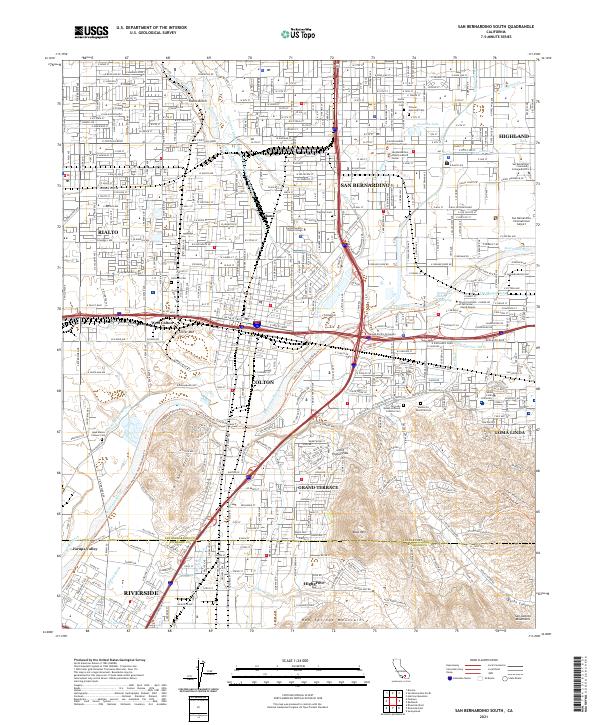
2021 Map of San Bernardino South
USGS Topo · Published 2021About this map
San Bernardino and its neighboring communities of Rialto, Colton, and Loma Linda anchor this detailed 2021 study of the Inland Empire. The landscape is a complex intersection of historic transit and modern infrastructure, where the BNSF Railway and major highways cross the alluvial plains of the Santa Ana River and Lytle Creek. Of particular interest to genealogists are the numerous burial grounds, including the Agua Mansa Pioneer Cemetery and Home of Eternity Cemetery, which reflect the area's diverse early settlement history.
Find a feature on this map
55 named features on this map. Tap any name to fly to it.
Don’t see what you’re looking for? This feature index may not catch every label — zoom into the map to look around manually.
Map Details
Editions of this 2021 San Bernardino South Map
This is the sole edition of this map. No revisions or reprints were ever made.
Other maps of this area

1896 · San Bernardino
USGS Topo · 1:62,500

1898 · San Bernardino
USGS Topo · 1:62,500

1899 · Redlands
USGS Topo · 1:62,500

1901 · Southern California Sheet No. 1
USGS Topo · 1:250,000

1901 · San Bernardino
USGS Topo · 1:62,500

1901 · Redlands
USGS Topo · 1:62,500

1901 · Elsinore
USGS Topo · 1:125,000

1901 · Riverside
USGS Topo · 1:62,500

1904 · Southern California Sheet No. 1
USGS Topo · 1:250,000

1936 · Devore
USGS Topo · 1:31,680