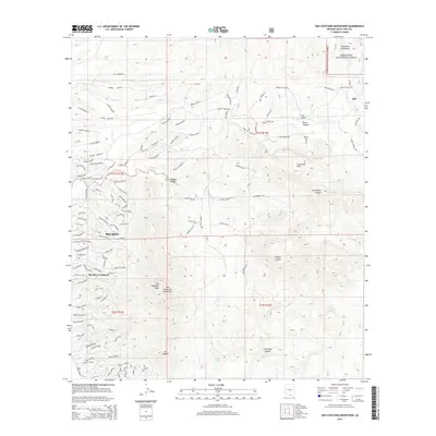
2014 Map of San Cayetano Mountains
USGS Topo · Published 2014About this map
San Cayetano Peak dominates the southern landscape of this 2014 survey, anchoring the peaks of the San Cayetano Mountains as they rise above the development of Rio Rico. The map illustrates a striking contrast between the modern residential street grids of Rio Rico Northeast, characterized by winding drives like Camino Tavera and Camino Libertad, and the undisturbed reaches of the Coronado National Forest to the northeast. To the east, the terrain becomes increasingly complex through the Grosvenor Hills and Cieneguita Canyon. Historic points of interest are scattered across the high ground, including the settlement of Alto and the remote Tejano Spring, reflecting the area's long history of ranching and resource management within the Santa Rita Mountains range. Water sources such as Coal Mine Spring and Chivas Tank remain critical landmarks in this arid environment.
Find a feature on this map
125 named features on this map. Tap any name to fly to it.
Don’t see what you’re looking for? This feature index may not catch every label — zoom into the map to look around manually.
Map Details
Editions of this 2014 San Cayetano Mountains Map
This is the sole edition of this map. No revisions or reprints were ever made.
Other maps of this area

1904 · Patagonia
USGS Topo · 1:125,000

1905 · Patagonia
USGS Topo · 1:125,000

1905 · Nogales
USGS Topo · 1:125,000

1920 · Arivaca
USGS Topo · 1:125,000

1921 · Old Glory
USGS Topo · 1:125,000

1922 · Agus Caliente
USGS Topo · 1:62,500

1933 · Calabasas
USGS Topo · 1:62,500

1939 · Tubac
USGS Topo · 1:62,500

1942 · Ruby
USGS Topo · 1:62,500

1943 · Old Glory
USGS Topo · 1:125,000