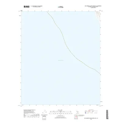
2018 Map of San Clemente Island Central OE S
USGS Topo · Published 2018About this map
Pacific Ocean waters dominate this 2018 coastal survey, illustrating the maritime environment surrounding the offshore territory of Los Angeles County. The map focuses primarily on the open sea, providing precise bathymetric and navigational coordinates for the waters of the San Clemente Island Central OE S quadrangle. The only terrestrial presence is a small, steep section of land in the northeast corner of the sheet, where closely packed contour lines indicate a dramatic rise in elevation directly from the shoreline. This stark contrast between the expansive deep-water surface and the sudden topographic relief of the island's fringe offers a clear look at the geological profile of California's Channel Islands region in the early 21st century.
Find a feature on this map
1 named feature on this map. Tap any name to fly to it.
Don’t see what you’re looking for? This feature index may not catch every label — zoom into the map to look around manually.
Map Details
Editions of this 2018 San Clemente Island Central OE S Map
This is the sole edition of this map. No revisions or reprints were ever made.
Other maps of this area

1943 · San Clemente Island Central
USGS Topo · 1:24,000

1950 · San Clemente Island Central
USGS Topo · 1:24,000

1957 · San Clemente Island
USGS Topo · 1:250,000

1980 · San Clemente Island
USGS Topo · 1:100,000
2012 · San Clemente Island Central OE S
USGS Topo · 1:24,000
2012 · San Clemente Island Central OE E
USGS Topo · 1:24,000
2012 · San Clemente Island Central
USGS Topo · 1:24,000
2012 · San Clemente Island South
USGS Topo · 1:24,000
2015 · San Clemente Island Central OE S
USGS Topo · 1:24,000
2015 · San Clemente Island South
USGS Topo · 1:24,000