
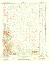
1948 Map of San Diego Mountain
USGS Topo · Published 1954About this map
San Diego Mountain rises above the eastern bank of the Rio Grande, anchoring a landscape defined by livestock research and desert ranching in the late 1940s. The map illustrates a region transitioning from rugged natural terrain into a managed agricultural laboratory, prominently featuring the Jornada Experimental Range and the New Mexico A & M College Animal Husbandry Ranch. The reliance on water management in this arid environment is evident through a network of isolated water points such as Open Diamond Tank No 1, Thorn Well, and Detroit Well. Transportation and early settlement are anchored by the Atchison Topeka and Santa Fe railroad, which follows the river corridor past Tonuco and south toward Radium Springs. Cultural markers like the A & M College Headquarters and the Real Ranch provide specific points of interest for those tracing the history of institutional and private land use in Doña Ana County.
Find a feature on this map
24 named features on this map. Tap any name to fly to it.
Don’t see what you’re looking for? This feature index may not catch every label — zoom into the map to look around manually.
Map Details
Editions of this 1948 San Diego Mountain Map
2 editions found
Other maps of this area

1891 · Las Cruces
USGS Topo · 1:125,000

1893 · Las Cruces
USGS Topo · 1:125,000

1916 · Tonuco
USGS Topo · 1:125,000

1932 · Tonuco
USGS Topo · 1:125,000

1941 · Las Cruces
USGS Topo · 1:62,500

1941 · Organ Peak
USGS Topo · 1:62,500

1943 · Organ Peak
USGS Topo · 1:62,500

1943 · Corralitos Ranch
USGS Topo · 1:62,500

1943 · Las Cruces
USGS Topo · 1:62,500

1948 · Chicken Well
USGS Topo · 1:62,500