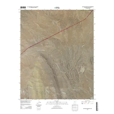
2013 Map of San Felipe Pueblo NE
USGS Topo · Published 2013About this map
The Mormon Battalion Monument stands as a significant historical marker in this high-desert landscape of Sandoval County, commemorating the long-distance march of a volunteer religious unit during the Mexican-American War. This arid expanse is defined by a series of deep drainage systems, most notably the Arroyo de la Vega de los Tanos and Arroyo del Tuerto, which dictate the local topography and historical travel routes. Land use in this area is characterized by sparse ranching outposts like Blackshare Ranch and a network of secondary roads such as Camino de Dolores and Hagan Rd. The presence of Indian Service Route 88 and various land section boundaries like t14n r6e reflects the complex layers of tribal, federal, and private land management common to this region of New Mexico.
Find a feature on this map
19 named features on this map. Tap any name to fly to it.
Don’t see what you’re looking for? This feature index may not catch every label — zoom into the map to look around manually.
Map Details
Editions of this 2013 San Felipe Pueblo NE Map
This is the sole edition of this map. No revisions or reprints were ever made.
Other maps of this area

1892 · San Pedro
USGS Topo · 1:125,000

1892 · Santa Clara
USGS Topo · 1:125,000

1953 · Santo Domingo Pueblo
USGS Topo · 1:24,000

1953 · Tetilla Peak
USGS Topo · 1:24,000

1953 · Santo Domingo Pueblo SW
USGS Topo · 1:24,000

1953 · Agua Fria
USGS Topo · 1:62,500

1953 · Santo Domingo Pueblo
USGS Topo · 1:62,500

1954 · San Felipe Pueblo
USGS Topo · 1:24,000

1954 · Placitas
USGS Topo · 1:24,000

1954 · San Felipe Pueblo NE
USGS Topo · 1:24,000